The first part of the exploratory experience was to find the trail! I could see from the map that it went through Buckley so I drove there. I should have been thinking and realized that many of these towns grew up around the railroad, and this was a Rails-to-Trails path. The path went right through the middle of town! I hopped on the fixed gear bike and pedaled west(ish), not with a particular plan or destination in mind.
I had to pass through a busy multi-street intersection. There were several crosswalks to navigate. Luckily, there was information to keep me occupied while I waited for the signal to cross.
 |
| Of course, you can always click on photos to view full size and more easily read any text |
I made my way through the intersections and was met with a long straight run through the trees.

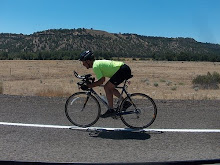
As I was mounting the bike preparing to ride, a guy on a flat bar bike passed by. I took pursuit and was not surprised to find that it was an E-bike. We cruised along at 17-18 mph and talked about bike life. I didn't stop for any photos until we reached Orting. This was Tom's finish point, and my turn around point for today.
 |
| Tom, post ride, barely breaking a sweat! |
I pedaled back with plans to ride a bit slower, and to stop for photos from time to time.
The first thing I noted as I turned around was that "The Mountain" had been behind me the whole time!

The trail followed the somewhat unpredictable Carbon River for a significant distance.


In addition to this former rail bed being slightly uphill on my return, today it was also experiencing a brisk head wind.

On the plus side, the east wind over the Cascade summit was responsible for record setting warmth. (61 F in Seattle) As I reached South Prairie, the explanation of the broad flat bottomed valley was explained on this trail side reader board.

Tom and I had talked about lahars and earthquakes. After reading this sign, I wonder how fast I could ride my bike if I really needed to get out of Dodge quickly?. ;-) (ANSWER: Not fast enough!)
One of the sure ways of knowing you are likely traveling on a former railroad bed are deep cuts to allow relatively flat passage through small hills.

As I was wrapping this 25 mile ride up, I noted that I could have looked at a map of the route.
It looks like there is much more to explore.

I wonder what the chance is that next time the mountain will be out again?


Today .....25.................0..................0....................0...........25
Jan.........26................ 0................0.....................0..............26
Feb.........7..................0................0.....................0...............7
March.......5.................0................0.....................0...............5
April.......0.................0...............66.....................0...............66
May.........0..................0..............79......................0...............79
June........2..................0...............0......................0...............2
July........64.................0...............0......................0...............64
August......11..................0...............0.....................0...............11
September 0..................0................0.....................0................0
October 0..................0...............0......................0................0
November 147................0................0......................0...............147
YTD........265...............0...............154.....................0.............419


No comments:
Post a Comment
Thanks for taking the time to leave a comment.