But back to the beginning. I started off with having to get across the Willamette River. Unless I want to detour 15 miles or so, that means riding about three quarters of a mile along Interstate 5 to access the Boone Bridge.
 |
| Taken looking upstream from the Boone Bridge |

I decided on a change of pace and took Champoeg Park's bike path from Butteville to the main park. I was vigilant for icy spots but none were seen.


The Champoeg area is the location where the Provisional Government of the Oregon Territory was voted on and approved. Today it is a State Park providing both history and camping.
 |
| The Willamette River's flood plain just upstream from Champoeg |
The area is an agricultural gold mine. Mild climate, fertile soils, adequate water supply, and zoning that prohibits urban sprawl all make this area great for growing hops, vineyards, nursery crops, alfalfa, vegetables, berries of all varieties, grass seed, hazelnuts, and cereal grains. Most of the farms have been owned by the same families for generations.


I turned south, following closely the Willamette River upstream. I had a pretty decent tailwind. Even on the fixed gear bike I was moving along at ~20 mph, with no wind noise at all. With no derailleur manipulating the chain the bike was moving along in near silence. I knew I would pay for this later when I had to make my way back north. For now I just enjoyed the trip.
 |
| Mt Hood, Oregon's tallest peak at 11,250 ft |
I rode through St Paul , home to the oldest brick building in the Pacific Northwest, as well as many Oregon firsts. Today I would stop at the small convenience store and get new batteries for my camera!
I continued south, with some trepidation given the strength of the tail wind. I was on River Road and just breezing along.

I continued south until I reached Keizer. At that point I thought it would be a good idea to start in on the long ride back north into that pesky wind. It wasn't going to get any easier, and with the wind's increasing speed as the day wore on, I figured it could get a lot worse!
I was dressed for the 28 degrees as I started this morning, not for exerting a lot of energy into a head wind. I had time, so I took it. I pedaled along as easily as I could given the head wind. I was able to hold about 10 mph give or take depending on terrain and direction. It was going to be a long return, but I figured I had time to make it.
 |
| The tall poles in the fields on both sides are supports for hops. |
I continued plodding along.

If you can ignore the wind (hah, just try that once!) it was a perfect day in November.
 | |
| Mt Hood behind nursery stock and a "sleeping" hop field |
I followed the Willamette Valley Scenic Bikeway Route back to near Champoeg but turned toward Butteville at the last minute. I took a short break to wander down to the historic paddle wheel steamboat landing location.

I took one more brief stop at the French Praire Public Access point at mile 41 of the Willamette River. I primarily stopped here to scope out amenities and ease of kayak launching. The gate was closed though I was able to get around it. I'm not sure if the access point is permanently closed, or just for the season. The Willamette River provides 187 miles of paddling opportunity, plus a few miles additional up it's forks. It would make a great multiday paddle. Today the most scenic part of this stop was the road back to the river. ;-) There was a deer feeding there, but it scampered away before I could get the camera out.

I took the unofficial alternate river crossing. I was tired of fighting the wind and instead of riding along I-5 to get across the Willamette River as I had on the outbound ride, I carried my bike up the bank to the train tracks and rode across the railroad bridge. There is a narrow "worker sidewalk" along the side of the tracks. I'm not sure the railroad would be too keen on my use, but it made for a low stress way to get back home.

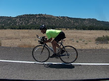
It was a good day on the bike, though challenging given the brisk headwind and choice of fixed gear bike. Would I do it again? Sure!
...........road bike..........rollers.........mtb..........lifecycle.......total Today...........71...............0..............0...............0.............71 Jan.............710...............0..............0...............0............710
Feb............ 578...............0..............0...............0............578
March ..........701...............0..............0...............0............701
April...........749...............0..............0...............0............749
May.............613...............0..............0...............0............613
June............309...............0..............0...............0............309
July............615...............0..............0...............0............615
August..........359...............0..............0...............0............359
Sept............292...............0..............0...............0............292
Oct.............708...............0..............0...............0............708
Nov.............337...............0..............0...............0............337 Total..........5873...............0..............0...............0...........5873


No comments:
Post a Comment
Thanks for taking the time to leave a comment.