The Seattle ride has been a bit more challenging for me since I'm not nearly as familiar with the roads. After one error in planning where I just wasn't comfortable leading a group of folks on those roads, I planned another. This time I "streetviewed" most of it. Today I took off to scout THIS NEW ROUTE that is scheduled for Feb 8th.
It held promise "on paper" and should offer some nice views.
I had a delay of game today, having to mess with my Garmin, soft reset, factory reset, load route, repeat process, etc. By the time I got out I was concerned that I might not get the whole route biked before dark.
I loaded the bike in my pickup and took off.
I drove some of the route, biked some of it. It is going to be fun! There was one section of about 4 miles near Edmonds that had no shoulder and was a bit curvy, but I had to route on it if I wanted to take in a view point that looked across to the Olympic Mountains. When I got there I found that the road indeed had no shoulder, and yes, was a bit twisty, but it also had a 25 mph speed limit!

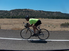
Despite the blue skies, there was enough moisture in the air to obscure the Olympics.

The route passed by many schools. I was surprised to find that near the schools there were no painted bike lanes, and often not very good shoulders. No wonder younger folks don't ride bikes much.
I had mapped it near Lake Serene, thinking there might be some nice views there. There were some pretty fancy homes and manicured neighborhoods, but all of that hid the lake from the eyes of we commoners. I did manage to get one glimpse of the lake between houses. The light was from the wrong direction, but I didn't have much choice.

Just before crossing I-5, the route sent me down a street signed "no outlet". While that might be true for motor vehicles, bicyclists with a sense of adventure can find a way.

It looks worse than it is. After about 25 feet this gravel path drops onto the Interurban Trail and follows it for just over a mile. Shortly after crossing over I-5 I traveled along the shore of Silver Lake. This time I had an easier time seeing the lake, but it didn't seem quite as scenic. Spoiled I guess!

The route goes through an industrial park then turns right as the road turns left. It looked like it might be a section needed to be rerouted, but I found the gravel to be hard packed and quite ridable on skinny 23c tires. Around the back side of this lake the gravel trail joined up with a paved trail to finish it's way back to streets in about 3/4 mile. I won't bother rerouting, it will be a good break.

I continued on to Marymoor without any issues. I was on busier roads but there were excellent shoulders to ride on and great sight lines.
We are going to have fun!
..............road bike.......rollers.........mtb.....lifecycle........total
Today..............37...........0................0............0.............37 Jan.................584..............0...............0.........0.............584 Total............584.............0...............0..........0..............584


No comments:
Post a Comment
Thanks for taking the time to leave a comment.