

We started off at 9AM after good breakfast at the nearby Denny's. We rode the 2 miles back from the freeway to the center of town and hopped back on the Centennial Trail. The town has obviously embraced the trail (and the money it brought in?)


We continued on to Mt Vernon, at 27 miles nearly half way into today's 56 miles, where we stopped for chicken teriyaki, and a chuckle.

It was easy to determine where NOT to eat! ;-)
 |
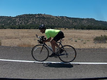
| Dave's photo |
 |
| Skagit River |
 |
| Not Bald Eagles, but still looking for a fish dinner |
 |
| Dave's photo |
 |
| Dave's photo |


 |
| Dave's photo |

 |
| Dave's photo |


When mapping the route I noted that ridewithgps wanted to put us on a path that ran parallel to the road. I had only been up this way once before and didn't remember seeing a path. We figured we'd play it by ear. As we neared the bottom of Chuckanut the Garmin told me to turn right. We did that, and found the trail, but it was gravel. It was probably rideable on my 28's, and certainly rideable on Dave's 38's but we both decided that the paved road still descending looked like a better choice.
 |
| Dave's photo |
As for today, we were glad to be done. Dave's daughter had gone to college in Bellingham and was back this weekend to run a marathon with friends. We met her for pizza.
.......Road bike........Rollers.......MTB.......Lifecycle....Total
Today........56...............0..............0..............0..............56
Jan..........765.............0..............0..............0.............765
Feb..........248............0..............0..............0..............248
March......183...........0...............0.............0...............183
April........228...........0...............0.............0...............228
May.........200............0..............0.............0...............200
June.........199...........0...............26...........0...............225
July..........246...........0...............0.............0...............246
August.....502...........0...............0.............0...............502
Sept..........876...........0..............44............0...............920
Total........3393.........0...............70............0..............3463


No comments:
Post a Comment
Thanks for taking the time to leave a comment.