
(as per usual, you may click on any photo for a full sized version)
I took off at daylight and headed up the shoulder of Soledad Mt and over to La Jolla. Traffic was VERY light, as in nonexistent, on this early Sunday morning. I got to the trendy little town of La Jolla and took a picture of the coast before beginning the climb up Torrey Pines.

It was still a bit cool out so the descent from the top of Torrey Pines (40 mph!)down to Carmel Valley was a bit chilly. I continued up the coast through Del Mar, Solana Beach, and Encindas (where I stopped for a breakfast burrito at Angelo's!)

On the outskirts of Carlsbad I turned inland and before long began to see the hills that were a precursor to the challenge ahead.


There were dark clouds around but winds were light. As I got into the Escondido and Valley Center area it was raining lightly. It continued to rain lightly for about the next hour. Not a lot of rain, but enough to make the roads...and my shoes, wet.
About 5 miles past Escondido, and 50 miles into today's ride I rode past Lake Wohlford.

As I rode farther inland I began to pass citrus groves. Like most fruits and vegetables oranges taste best fresh from the tree! ;-)

The directional signs pointed to the fact that there were many Indian reservations in the area.

I also passed several casinos, but unlike Oregon these seemed unaffiliated with the tribes.
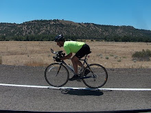
I was climbing steadily since leaving the coast, but began climbing in earnest as I turned up South Grade Rd. This steep and curvy road up Mt Palomar is a favorite of motorcyclists. It's amazing that I didn't see any crashes. I used to ride motorcycle, am familiar with what they can do, and probably have pushed them to their limit a time or two in my younger days.........but these guys (and a few gals!) where scaring the bejezus out of me. I'm not sure why CHP doesn't patrol this section. Seems a few cops up there could more than pay their way with the tickets they could write. Crossing double yellow lines, speeding, noise, all seemed like an easy call.

The climb was relentless but I just settled in to a "doable" gearing and pedaled up between 5.0 and 6.5 mph, most of the time in the mid 5's. The Amgen Tour of California used this section as Stage 8. I was riding the same route as "the fast boys"...albeit at a much slower pace! I had two full water bottles at the bottom but both were empty with about 2 miles still to go. When I finally got to the Mt Palomar General Store I picked up a bottle of water to refill my two bottles (one mixed with Accelerade and the other with Perpetuem)

I also got a 32 oz bottle of G2 Gatorade. I sipped away on the G2 until finally deciding there wasn't enough left to worry about and drank it! Probably a mistake.
I had worked up a sweat climbing and at the elevation (5200 ft) I was getting cold enough to shiver. I decided I couldn't wait to dry off, so I rolled the arm warmers back on, hopped back on the bike and began rolling down East Grade Rd. I shivered violently from time to time. A bit scary to be coasting down a winding road at 35-40 mph and shivering hard enough to make the bike shimmy! Along with the shivering I developed hiccups. I blamed it on too much G2 at one sitting. I put my bike in the big gear (56-11) and pedaled, not because I needed the speed, but because it helped warm me up. I did stop from time to time to take in the view.


I got down to Lake Henshaw.

It seemed that there was a grasshopper convention going on. The sky was just full of them, as were the sides of the roads.


I still had hiccups. Normally if I get them laying down for a bit alleviates them so I pulled into a grassy location that had a good view of the lake and laid down for a bit. The hiccups stopped in about 5 minutes and I rested a bit more just for good measure, total stopped about 15 minutes.
I hopped back on the bike and pedaled on, for "there where miles more before I sleep". Within 5 minutes the hiccups returned. They would stay with me the remainder of the ride. I was riding into a noticable wind and on rough chip seal besides. The fun was rapidly draining away.
At the little town of Santa Ysabel my course turned a bit and at least I wasn't riding directly into the wind.

While the route is more down than up for the last 80 miles I can tell you that there was still plenty of up.

My route took me along the Old Julian Highway, and older alternative to the busier Julian Rd, Hwy 78. It was a nice ride through some very scenic areas.
I passed this little oasis at mile 105 of today's journey.

I wasn't drinking or eating anything since the top of Palomar because it was just too difficult while hiccuping and I was hoping that just a bit of "rest" for my stomach might help. The lack of "fuel" was affecting me. By the time I got to Ramona I knew that hiccups or not, I had to eat something. I stopped at a Taco Bell and ate a crunchy taco with a glass of water.
I was doing a little mental arithmetic as I rode and figured that I would get back to Pacific Beach around 7:30.
However, it was not to be. You will note a little "out and back" leg to my route on the map that begins at mile 113. I had mapped the route on the computer then uploaded it to my gps. I followed my gps's instructions and turned onto Mussey Grade. There were two signs at the beginning of this road...one said "Dos Pecos County Park" and ominously the other said "no outlet". I double checked the gps and pedaled on........with trepidation. The road was descending, normally a good thing but I was fearing I may have to ride back UP! The road split with the right turn option heading for the park, again with a "no outlet" sign. The sort of straight ahead option didn't have a sign. As luck would have it a young girl on a horse came riding up. I asked her about the road and she told me she "thought" it went through. She said the other option ended at the park. I continued down, down, down, Mussey Grade.
After 5 1/2 miles of descending I rounded a bend on a road that had a centerline and foglines.........to see a big gate right across it. I was too ticked to even take a picture of it. I couldn't believe it.
I could see a reservoir down below me. It was San Vincente Reservoir. I knew from the lay of the land that if I could just get there I could salvage this leg of the ride. Downhill and SW was a good thing.........unless you had to turn back around and ride uphill and NE!
All of my time calculations went out the door, I knew I'd be finishing in the dark now. I turned the bike around and pedaled back up. When I got to the turn to Dos Pecos park I took a turn towards it. Soon a county cop came driving by. I flagged him down and asked if the road went through. He said no.
I pedaled back up to the Hwy and pedaled on. After several miles I saw the dirt trail that my gps informed me was my route.
Side note.......... after finishing the ride the first thing I did was bring the map up on the computer to figure out what happened. Indeed, the downfall of computer mapping is without doing a very close look at the roads from something like Google Earth there is no way know if the route is paved or gravel.......or dirt. The road from Dos Pecos park turns to a dirt trail just past the park. Drat, I didn't bring my mtn bike!
At any rate I was back on course and riding towards Pacific Beach. The taco in Ramona had helped. I still had the hiccups but was sipping some of my electrolyte drinks and had a power bar. I wasn't pedaling fast, but I was pedaling faster than I was earlier!
I had several reasons to try to keep a reasonable speed up. I was navigating solely by the little line on my gps. I don't know the area and didn't have a paper map or cue sheet along. The gps had been on continuously for over ten hours and the little power indicator told me there wasn't a lot of battery left. Also, while I had lights along I didn't want to be sharing the roads with California drivers in the dark any longer than necessary.
I pushed on as the daylight dimmed. The gps finally got down to "no bars" left on the battery indicator. I zoomed the display out trying to get a general idea of what turns I might be making. The Garmin 205 does not have a map, just a line on the screen that your are to follow. It generally works fine, as long as you intend to ride the premapped route, take no shortcuts, or want to do any "freelance riding" in an area. In this case it would have been nice to at least have street names so I could memorize the last few roads I should turn on.
Since I didn't have that info I just kept pedaling as long as the gps was telling me where to turn hopefully recognizing some street names soon.
I still had hiccups, but at least my luck held on the gps. Before long I turned onto "Balboa St". I always read street signs, even when driving a car. In this case it paid off because I remembered that I had exited off I-5 onto Balboa when I drove down here 3 weeks ago. I didn't know how far I had to go (since I had taken my little Mussey Grade detour that added to my trip) but knew that I should be able to find my way back even if the gps died now. In a few miles I passed under I-5. It was pitch black, I would have loved to have been in Oregon, the sun would have been up yet! I had two Planet Bike Super Flashes on the back and a white Planet Bike 1 watt in blink mode on the front. The roads had good shoulders, and I knew I only had a few miles to go. Things were looking good.
I was in town now, stop signs, merges, signals, traffic, all required attention.
With about 10 blocks to go I pulled up to a four lane road with a stop sign (as always, controlling the lane) A car came in behind with a right turn signal on. I tried to show a little "kindness" to the car and scooted a few feet to the left to allow them to turn right while I was waiting to cross. Legs where a bit tired, and I still had one foot clipped in. As I scooted over I lost my balance and went down. The car pulled up, looked down at me, and proceeded to turn right. I wasn't hurt, but it just amazed me that the driver wouldn't have said "thanks" or asked if I was okay..........or even acknowledged that I had move over for her.
My camera was in my back jersey pocket and the fall cracked the case a little, but beyond that nothing else seems damaged.
I finished up the ride. As I pedaled up to the entryway the Garmin gave me the first warning tone that the battery was dead. Normally I'd get about a minute or so of beeps before it powers down. 14.5 hours "on" continuously!
The San Diego Tour Guide was happy that I had made it back, and I was happy to be back. I parked the bike and laid down while recounting the ride. The hiccups went away. I took a LONG hot shower. A good way to end a good but challenging ride.
My Cateye tells me 159.65 miles, depending on which mapping program I use total climbing was somewhere from 12,134 to 15,783 ft. I guess perhaps the most accurate thing to say when asked about total elevation gain would be to answer "significant". ;-)
+++++++++++++++++++++++++++++++++++++++++
...............Road Bike.....LifeCycle.....Total Miles
Today...........160...............0................160
Jan total.......501.....+.........30.......=.......531
Feb total.......614.....+.........0........=.......614
March total.....860.....+.........0........=.......860
April total.....790.....+.........0........=.......790
May total.......901.....+.........0........=.......901
June total......403.....+.........0........=.......403
Year to date...4120.....+.........30.......=......4150
+++++++++++++++++++++++++++++++++++++++++


Sounds like a perfect ride! Hills, rain and wind. Just like Oregon!
ReplyDeleteOh, and forgot to mention, there was lots of rough roads and chipseal the last 50 miles or so too. ....just like FC 508! ;-)
ReplyDelete