As I drove to Joe's home, I was met with wet roads when just a few miles away. It continued to rain very lightly as the group gathered.
 |
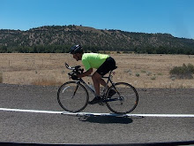
| The gang is introduced to the SAG drivers |
 |
| Dave S. photo |
With my lack of riding this year I knew I'd likely be the slowest on the road today. I planned to keep my bike moving. It was a tortoise and hare game plan that I'd hoped would see me back to Gresham before dark.
Joe had provided for 3 support vehicles. I bypassed the first SAG meeting spot and just kept riding. I had plenty of water on this wet morning to ride 10 miles, and then some.
As I pedaled by the meeting point and saw the gang standing around the SAG vehicle, I knew that I was now near the front of the "peloton".
 |
| Dave S. photo |
Needless to say, that was a wakeup call! To be dead last so early into this event was not good.
I pedaled along and caught up with Steve, we chatted a bit, then I pedaled on up the road.
I caught up to a couple of the other riders in our group, and passed them just before our next "off Hwy 26 side trip" onto Kiwanis Camp Road (aka Rd 39)
This was a nice alternative to riding Hwy 26 which is undergoing construction in the zig zag turns just below Government Camp. Road 39 is evidently the old road before the new Hwy 26 was built. There was some artful old concrete work at bridges that indicated the road's historic significance. The road has been made impassable to motor vehicles so it was just us bikes (and any intrepid hikers) that would by going through today.
The first few miles were driveable as it provided access to a few organizational camps and some trailheads. Where the road crossed a creek it became an abandoned road only accessible to us. There was asphalt the entire way, but the vegetation was creeping in from the edges.
 |
| Joe T. photo |
 |
| Joe T. photo |
 | ||||||
| Where is all the snow? |
After we passed Government Camp we dropped into the White River Canyon, then climbed to the high point of today's ride, 4674 ft Bennett Pass, I rode along with one of the women as she slowly made her way up Bennett Pass . I know that it is no fun to be out there all alone. Once we hit the summit she pulled off to avail herself of the SAG vehicle stationed there, I kept on rolling, now facing a 40 mile, 4600 ft descent. This was going to be fun!
There were good views to be had as I rolled down toward Hood River.
 |
| Mt Hood |
 |
| Mt Adams |
Those that were still at the store when I left caught up soon enough, and immediately dropped me.

Our next rendezvous point was in Hood River . As I rolled through I waved at the gang, who were gathered near McDonalds but I kept moving. I made a quick stop at a gas station's convenience store for an ice cream sandwich. It had warmed up a bit, and ice cream sounded good!
Once in Hood River our route would turn west, into a wind that was now blowing in our faces in the 15-17 mph range.
I struggled along about 10-12 mph. My lack of bike fitness was showing. After a few miles the peloton came up on me and invited me to fall in line. We soon formed a double pace line and my speed immediately jumped up to 14-16 with the benefit of some strong riders riding point.
 |
| Dave S. photo |


It will be nice when ODOT finally finishes the last 10 miles .(if you have any interest at all in the Historic Columbia River Gorge trail project click HERE) If you'd like to contribute time, talent, dollars, or just add your voice to those wanting to see this project move forward quickly go HERE.
The gang pulled off again in Cascade Locks. I continued on , because that is what a tortoise does! I stopped at a drinking fountain just before accessing the old Historic Columbia River Gorge Hiking Trail on the west side of town and refilled my water bottles.
I love this section of the route. The hills are gentle (the old highway was built with maximum grades of 5%) and the scenery is superb!

At Tooth Rock the old road was left hanging high and dry when the freeway was built. Up to just a few years ago bicyclists traveling through here had to ride the freeway through the Tooth Rock Tunnel. Now the new trail connector accesses the orphaned historic road via a staircase. There is a track built along the side of the steps allowing heavy bikes to be rolled along rather than carried.

I knew that there were still about 30 miles to go, with some pretty decent hills. At the top of the stairway I ate one of the Clif Bars I was carrying to keep my energy level from dropping.

 |
| Bonneville Dam |

 |
| A new bridge on the connector, made to fit into the style of the old road. |

 |
| Horsetail Falls |
 |
| Multnomah Falls |


 |
| Vista House |
I was stopping to take photos and it wasn't a race. I just wanted to finish before dark! I knew that I was the slowest rider on the road, but was amazed how well I stayed up with the group. Two of the fastest riders caught me again about 200 yds from Women's Forum State Park (Chanticleer Point) which was the high point of this last big climb. They pulled off at the park, I rolled on down the hill. There was still plenty of climbing to come.
I rolled down to the Stark Street Bridge and crossed the Sandy River. I was now on the 2008 Race Across Oregon route, a section I remember well!
I turned on Kerslake Rd and began climbing. As I made my way along 302nd, grades reached 17%. This were the steepest climbing on the 2008 RAO and of our route today!
As I inched my way up these last steep pitches the fast boys caught me again. The 40 mph speed sign in the photo below was wishful thinking. I was riding closer to 4 mph. (but I was still riding!)
 |
| Joe T. photo |
I rolled into Joe's driveway as the number 4 rider, about 3 minutes after the leaders. I shifted into my small chain ring as I bounced along the driveway slowly. The chain jumped off and jammed between the 30 tooth and 42 tooth rings. My lack of forward motion made for a slow motion roll onto the lawn. As I lay there contemplating how to unclip and get upright, my Garmin played a little tune and displayed "training complete, you win!" Ha ha, I guess so!
As I walked the remaining 200 ft to the house, the peloton rolled in. There were still a few stragglers out on the route, and Joe was accompanying them back in.
We would be finished with our spaghetti dinner (thanks Lynette!) before the last riders came in with lights on.
I was carrying my light too, but was really happy that I didn't have to use it.
Thanks to Joe, Lynette, and the entire Turner family for putting together this great event, providing support vehicles, and even dinner afterward. It was a GREAT day to be on a bike!


I finished up with a 10.9 mph clock time average. That was good enough to keep up with those who were showing a riding average of 14-15 mph today.
.........road bike..........rollers.........mtb..........lifecycle.......total
Today............140..............0...............0...............0.................140
Jan...............765...............0...............0...............0...............765
Feb................248...............0...............0...............0................248
March...........183.................0................0..............0................183
April..............228...............0................0...............0 ................228
May................200................0...............0...............0.................200
June................199.................0..............26...............0.................199
July.................246................0...............0.................0...............246
August............208...............0.................0................0.................203
Total............2339...............0...............26...............0..............2365


Nice pics and commentary. Thanks again for hanging with me as I chugged slowly up to Bennett Pass--I really appreciated the support and company!
ReplyDeleteAnd one more round of HUGE thanks to Joe, Lynnette, Maddy, Jackson, and Colleen!
Xande